A Map of the Mill Lands also a small Lot north of the Road being parts of Clonturke Corporation Estate as lately divided by the New Road.
Ornamentation: Fleur-de-Lis pointer
Show More
CONTRIBUTOR
Arthur R. Neville
DATE
1822-01-01 - 1822-12-31
LANGUAGE
ITEMS
1
INSTITUTION
Dublin City Library and Archive
PROGRESS
START DATE
TRANSCRIBERS
CHARACTERS
LOCATIONS
ENRICHMENTS
METADATA
Discover Similar Stories

A Map of part of the Lands of Clonturke in the County of Dublin estate of the Corporation of the City of Dublin.
1 Item
Plan of 29 fields numbered consecutively 53-81, giving acreage and cultivation of each. Shading also indicates varying types of cultivation. Dublin-Swords-Drogheda road runs through fields which are adj. To Sir Compton Domville's estate.
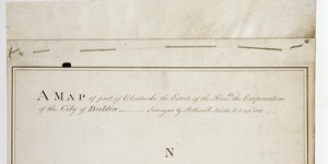
A Map of part of Clonturke Estate of the Corporation of the City of Dublin
1 Item
This map plots the same ground as C1/S1/124
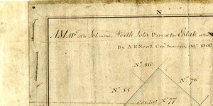
Map of a Lot in the North Lotts, part of the Estate of the Hon. City of Dublin
1 Item
City Lot No. 77 with an area of 2 acres, 1 rood, 22 perches. Adjacent to lots 55-56, 76, 78, 85-86