Map of a piece of Ground Situate on the S. East Side of Clarendon Street and S. West Side of Exchequer Street. City Estate. Traced from a Map done by Moland and Surveyed by Mathews
Plan of 5 holdings, giving measurements. Originally numbered 1-5 and reference table lists occupiers. Later inscribed 37-41 and names of later occupiers given. Also shown: area formerly called William's Field on south west. Compass Cross
Show More
CREATOR
Thomas Mathews
DATE
1781-01-01 - 1781-12-31
LANGUAGE
ITEMS
1
INSTITUTION
Dublin City Library and Archive
PROGRESS
START DATE
TRANSCRIBERS
CHARACTERS
LOCATIONS
ENRICHMENTS
METADATA
Discover Similar Stories
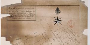
Map of two parcels of Ground Situate on both sides of Suffolk Street west side of Grafton Street and north side of Exchequer Street, part of Estate of City of Dublin
1 Item
Ornamentation: Engraved compass starengraved Fleur-de-Lis pointer

Map of a piece of ground on the East Side of Rosemary Lane, City Estate.
1 Item
For Merchants Quay scale at 20 ft:1 inch

Map of a piece of Ground on the East side of Trinity Lane part of City Estate
1 Item
Plan of holding on Trinity Lane, with measurements. Adj. To Abraham Creaton's holding on northwest and to Andrew Concannon's on northeast; Robert Bouynge's holding is on southwest