Map of Premises to which the Deed Refers
Map showing location and dimensions of premises on the north side of High Street, bounded on the north by Saint Audeon's Church, on the east by Mr Page's Holding and on the west by a passage from High Street to Saint Audeon's Church. Scale: 20 feet to an inch.Materials: Coloured ink.
CONTRIBUTOR
Dublin City Library and Archive
Sherrard and Co.
Sherrard
DATE
1822-01-01 - 1822-12-31
LANGUAGE
eng
ITEMS
1
INSTITUTION
Dublin City Library and Archive
PROGRESS
METADATA
Discover Similar Stories
Map of Premises to which the Deed Refers
1 Item
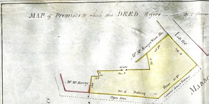
Map showing location and dimensions of premises on the south-west side of Store Street and the west side of Mabbot Street, bounded on the north by a lane, on the west and south by holdings of Mr Kenny and on the east by Store Street and Mabbot Street. Map torn at lower end Scale: area with scale torn. Materials: Ink and water colour.
Map of the Premises to which this Deed Refers
1 Item
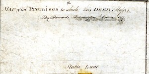
Map in two parts showing location and dimensions of premises on the north side of Eden Quay, south of a stable lane, bounded by property leased by the Commissioners of Wide Streets to Charles Pentland and William Cassin and premises on the east side of Werburgh Street, north of Werburgh Church and south of Castle Street. Scale: 40 feet to an inch. Materials: Ink and water colours.
Map of Premises to which the Annexed Deed Refers
1 Item
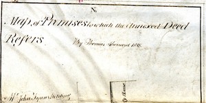
Map showing location and dimensions of premises on the west side of Hawkins Street, bounded on the north by Mr John Fyan's holding, and on the west and south by the property of James Donovan Junior. Also shows a stable lane to the west and the former Dublin Society House on the east side of Hawkins Street. Note in the bottom right corner states conditions relating to the building of a passageway at the south of the premises. Scale: 40 feet to an inch. Materials: Coloured ink.